Water returns where roads had blocked it. In southern Florida, the Everglades are testing a patient rebuilding project after losing about half of their historic system. The old network of canals could be repaired if the marsh finds its slow southbound rhythm again.
Un marais géant réduit de moitié par un siècle d’aménagements
Listed by UNESCO, Everglades National Park protects the southern end of a broad river of grasses. The National Park Service notes that the historic system exceeded 4 million acres, roughly twice the size of Corsica.
Since 1900, drains, dikes, and canals have reduced this territory by about half. This loss isn’t limited to a vanishing surface. It has also broken sheet flow, that very slow movement that spreads water like a sheet drawn across a table.
Les routes et les canaux ont changé le trajet naturel de l’eau
In the early 20th century, the State of Florida sought to protect towns, open land for farming, and limit the overspills from Lake Okeechobee. Engineers then sent some of the water toward the Atlantic, instead of letting it flow south.
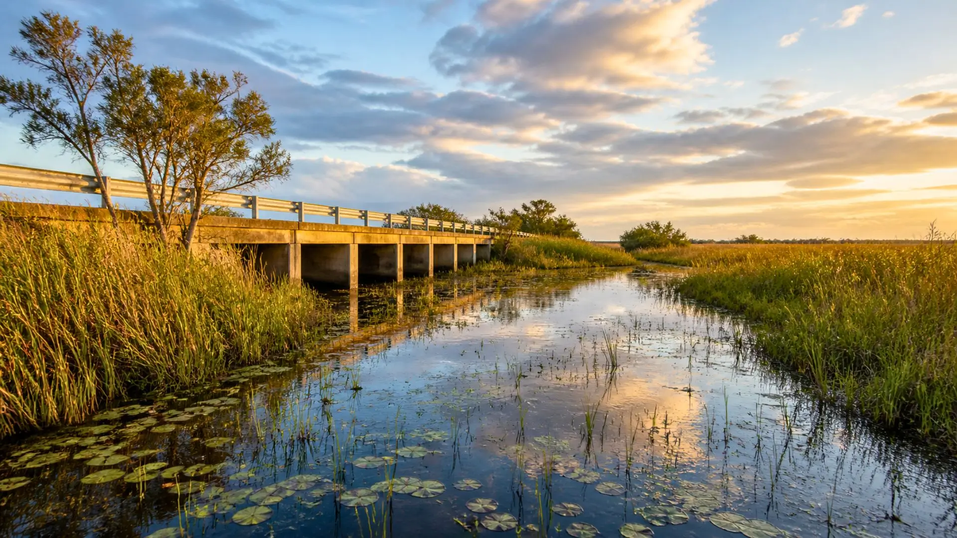
The Tamiami Trail, a road opened in 1928 between Tampa and Miami, added an almost horizontal barrier across the marsh. Like a door threshold set too high, the roadway held freshwater to the north and deprived the park of a steady flow.
After the hurricanes of the 1940s, the arrangement hardened further with the Central and Southern Florida Project. This network of dams, pumps and canals secured populated areas, but it also accelerated drying and concentrated agricultural pollution.
La salinité et le phosphore en excès fragilisent les herbiers, les poissons et les oiseaux
Salinity refers to the amount of dissolved salt in water. When less freshwater reaches the estuaries, the sea intrudes more easily into the mangroves and the bay. This change alters the grasses, the fish, and the birds that rely on a stable mix.
The phosphorus, a nutrient useful to plants, becomes problematic when it arrives in excess from agricultural runoff. In a nutrient-poor marsh, repeated inputs can favor other vegetation over the local grasses, much like an over-fertilized aquarium.
Le plan CERP répare le flux d’eau douce, chantier après chantier
The Comprehensive Everglades Restoration Plan, or CERP, was adopted by Congress in 2000. This federal-state plan brings together the US Army Corps of Engineers and the South Florida Water Management District. It aims to restore the quantity, quality, timing, and distribution of water.
The project advances piece by piece. Some bridges raise certain sections of the Tamiami Trail, some canals are filled in, storage zones hold the water before it is filtered. The partnership operates on a 50-50 basis between the State of Florida and the federal government.
The program remains long, costly, and subject to climate. The National Park Service cites more than $10.5 billion and a duration exceeding 35 years. In the marsh, the measurable result remains the same: more clean water flows southward.
Contact details
Address:
Farmers Forum,
36, Dominick Street,
Mullingar,
Co. Westmeath,
Ireland
Phone:
+353 (0)44 9310206
Or email us:
For technical issues please check out our FAQ's page or email - [email protected]
For general Queries email - [email protected]
Request to add event to our Calendar - [email protected]
Send us your mart reports - [email protected]
Suggestions and feedbacks - [email protected]
News Items / Press Release - [email protected]
To Advertise on Farmers Forum - [email protected]