The Atlantic rolls in with a restless hush, and the cliffs of Achill answer with a deep, stony calm. In July the light lingers, the sea turns glass-green, and the hills wear a salt brightness that feels both ancient and new. You get space, you get silence, and you get that dizzying edge where Ireland runs out and the ocean begins.
What sets this coastal ridge apart
This is a wild walk that favours solitude, where the drama comes unfiltered and the horizons seem to tilt in your favour. Think broad ridges, vertical walls, and surf that combs the coves with a patient, tidal breath. You’ll see as many sheep as humans, and more seabirds than selfies.
Compared with crowded hotspots, the vibe here is quieter, the earth underfoot rougher, and the choices on the map more open than marked. “It’s where the island remembers its bones,” a local walker once said, and it’s hard to argue with that.
The route in a nutshell
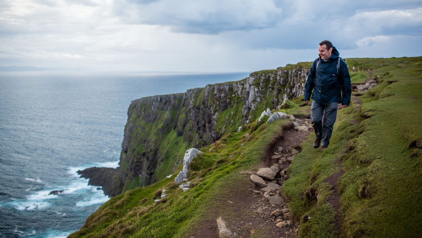
Start at Keem Bay, that bright amphitheatre of turquoise water and grazed slopes at the far end of the island road. From the car park, climb the grassy rib towards the high ground that rises above the north side of the bay. Aim for Croaghaun South Top and the sky-wide plateau, where the cliffs rear into some of the highest sea walls in Ireland.
Keep to safe setbacks from the void and ride the arc of the rim, looking down into dark corries where waterfalls blink and vanish. The route can be a loop if you contour back on lower ground, or an out-and-back wander if the wind digs its sharp heels in.
Expect 10–14 kilometres, depending on variants, with 700–900 metres of ascent and 4–6 hours of moving time. There’s little in the way of waymarking or fencing, which is both the point and the challenge.
July, when the light sticks around
Long days mean wide windows: early starts for empty ridges, late returns for molten gold on the water. July brings clarity, a soft breeze, and—on luckier days—basking sharks ghosting through Keem’s bay like drifting shadows.
Midges can nag in calmer pockets, but sea wind keeps most of them honest. Watch the forecast, because Atlantic weather still flips the switch without much warning.
Moments to look for
On the first big pull, look back to the horseshoe of Keem and the line of the old coastguard path curling the bluff. Higher up, the cliffs turn theatre, their black buttresses streaked with mineral tears, fulmars clipping the air like thrown stones.
“The sea feels close enough to touch,” you’ll think, then realise there’s 400 metres of nothing between hand and spray. On calmer days you’ll hear the deep boom of swell in cave throats, a bass note for this wind-tuned stage.
Safety, the honest kind
These are unfenced edges, with real exposure, and the ground can be treacherously boggy near the lip. Keep a generous margin, because corniced peat and grassy ledges sometimes crumble without ceremony.
Fog can wipe the map clean in a minute. Bring a compass, know how to use it, and have both digital and paper backup. In strong winds, drop plans to flirt with the rim and follow inland spurs instead.
Route snapshot
- Start/finish: Keem Bay car park; loop via Croaghaun South Top
- Distance/ascent: 10–14 km; 700–900 m
- Time: 4–6 hours, add stops for ocean gazing
- Terrain: Pathless heath, steep pulls, cliff-rim grass
- Grade: Strenuous, strong navigators only in poor visibility
What to pack, and what to leave out
Go light but not skimpy: waterproof layers, warm mid-layer, hat and gloves even in July. Stout boots are smarter than slick trainers on sloped turf and wet peat. Carry 1.5–2 litres of water, high-calorie snacks, a small first-aid kit, and an emergency whistle.
A proper map for Achill and a baseplate compass belong in your bag. Drone pilots should check local rules and respect wildlife and other people’s quiet.
Wildlife and the living edge
Look for red-billed choughs tumbling on black wings, ravens carving circles, and peregrines stiff as thrown arrows. In the grass, bog cotton flickers like torn flags, and larks keep a silver thread of song above the heather.
“Walk softly, leave only footprints, take only time,” a hand-painted sign once urged, and it’s still the right ethic here.
Getting there and winding down
From Westport, drive the N59 to Newport, then swing through Mulranny onto the R319 over the bridge to Achill. The last stretch to Keem is narrow and steep, so go early for easier parking and calmer roads.
Facilities are simple: seasonal toilets at the beach, food and coffee back in Keel or Dooagh. If you’re making a weekend of it, base in Keel for surf-rolled evenings and soft-sand walks before sleep.
Step off the ridge, sand in your boots, and you’ll carry that blue hush for days—the feel of a place both fierce and kind, and a path that asks for your full, present attention.
Contact details
Address:
Farmers Forum,
36, Dominick Street,
Mullingar,
Co. Westmeath,
Ireland
Phone:
+353 (0)44 9310206
Or email us:
For technical issues please check out our FAQ's page or email - [email protected]
For general Queries email - [email protected]
Request to add event to our Calendar - [email protected]
Send us your mart reports - [email protected]
Suggestions and feedbacks - [email protected]
News Items / Press Release - [email protected]
To Advertise on Farmers Forum - [email protected]