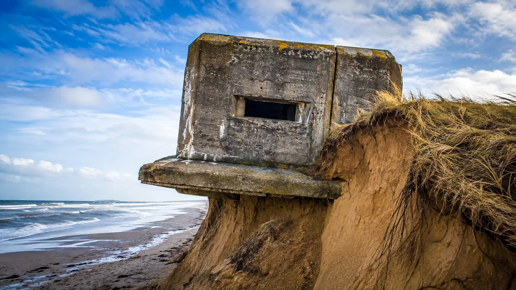
In 1944, concrete blocks teeter into the Atlantic Ocean. Far from mere military ruins, these giants resting on the sand measure coastal erosion with unprecedented accuracy, while also posing a major financial puzzle for coastal municipalities.
Colossal reinforced-concrete blocks built without deep anchorage, resting directly on dune sand
Between March 1942 and 1944, the German army erected some 15,000 fortified works along a corridor from Norway to Spain. This colossal undertaking mobilized 290,000 workers and consumed 13 million cubic meters of concrete. Yet these massive structures concealed a major structural vulnerability from their design from the outset.
A Class B shelter, for instance, required 775 cubic meters of concrete and 35 tons of steel. Once set, this fortress weighed nearly 1,900 tons. Even the small firing posts weighed several hundred tons on the sandy ground.
Each building rested solely on a foundation raft 80 centimeters thick, laid directly on compacted sand. The engineers had not planned any deep anchoring piles. Thus, the stability of these blocks depended entirely on the dune that sheltered them.
The abrupt shoreline retreat robs the ground from beneath the structures and drives them toward the sea
Geographer Marc Robin notes that these behemoths do not move on their own. In reality, repeated assaults by the waves erode the nourishing sand from beneath their base. At Pen Bron, the dune has retreated by 25 meters, causing a bunker to topple in May 2026.
Other coastal areas are facing the same fate. In Wissant, shoreline retreat has exceeded 20 meters in six years. Moreover, on the Île de Ré, four ouvrages slid after a dune retreat of 50 meters, while those at Pilat lie 100 meters lower.
A fixed and dated geographic position that turns these remnants into precise geological markers
Ironically, the German army left behind a valuable instrument for scientists. Erected at a known location in 1944, these monoliths are today reliable geological benchmarks. They allow researchers to gauge the rate of coastal erosion without relying on sometimes imprecise old maps.
Indeed, airborne LiDAR surveys and field measurements confirm the value of these historical witnesses. Researchers can readily compare their starting position with their eventual landing point. Consequently, these indestructible blocks illustrate the inexorable advance of the ocean onto the sandy lands.
Moreover, some ouvrages have completely disappeared beneath the water. In Gironde, divers now explore these submerged fortresses at twenty meters depth. Having become artificial marine habitats, these war debris now shelter a diverse underwater fauna far from their original wartime purpose.
A legal vacuum forcing municipalities to fund the security of these ruins on their own
Yet, the fall of these edifices raises a complex legal issue. Originally situated on private or municipal parcels, they shift into the public maritime domain as the tide advances. The State becomes theoretically responsible for managing these ruins that have become dangerous.
Nevertheless, public authorities do not always shoulder these costs. On the Île de Ré, local officials had to pay €275,000 to demolish four bunkers that posed a threat. This financially unjust situation weighs heavily on the budgets of small coastal municipalities left to fend for themselves.

Contact details
Address:
Farmers Forum,
36, Dominick Street,
Mullingar,
Co. Westmeath,
Ireland
Phone:
+353 (0)44 9310206
Or email us:
For technical issues please check out our FAQ's page or email - [email protected]
For general Queries email - [email protected]
Request to add event to our Calendar - [email protected]
Send us your mart reports - [email protected]
Suggestions and feedbacks - [email protected]
News Items / Press Release - [email protected]
To Advertise on Farmers Forum - [email protected]